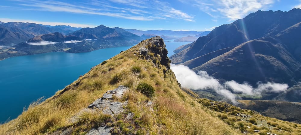
Walter Peak
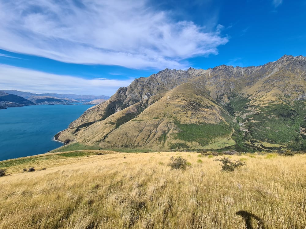
The 21st February 2024 saw us landing in a Sunny Queenstown, ready to take on the tramp to the top of Walter Peak. With Queenstown sitting at 300m above sea-level, the walk very quickly turns into a gruelling epic day's walk up 1,500m to a height of 1,800m above sea-level with glorious views.
As the peak is on private land, before embarking on this trip you will need to first obtain permission form the owner; contact can be made via the staff at Walter Peak Station.
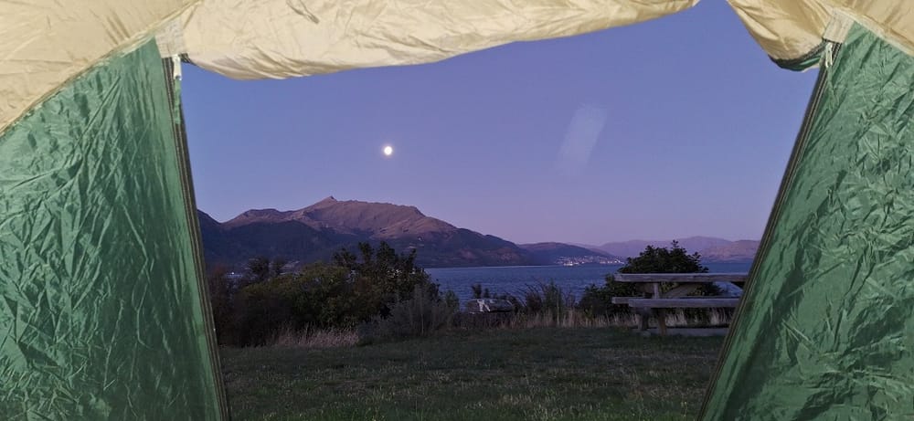
Starting at an Alpine Village Air B&B, My son-in-law and I off-loaded and repacked our gear, jumped on the TSS Earnslaw and headed for the Doc Campsite at Walter Peak Station.
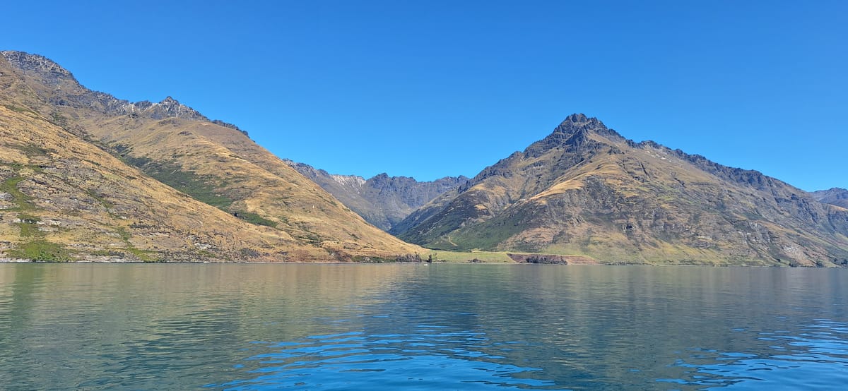
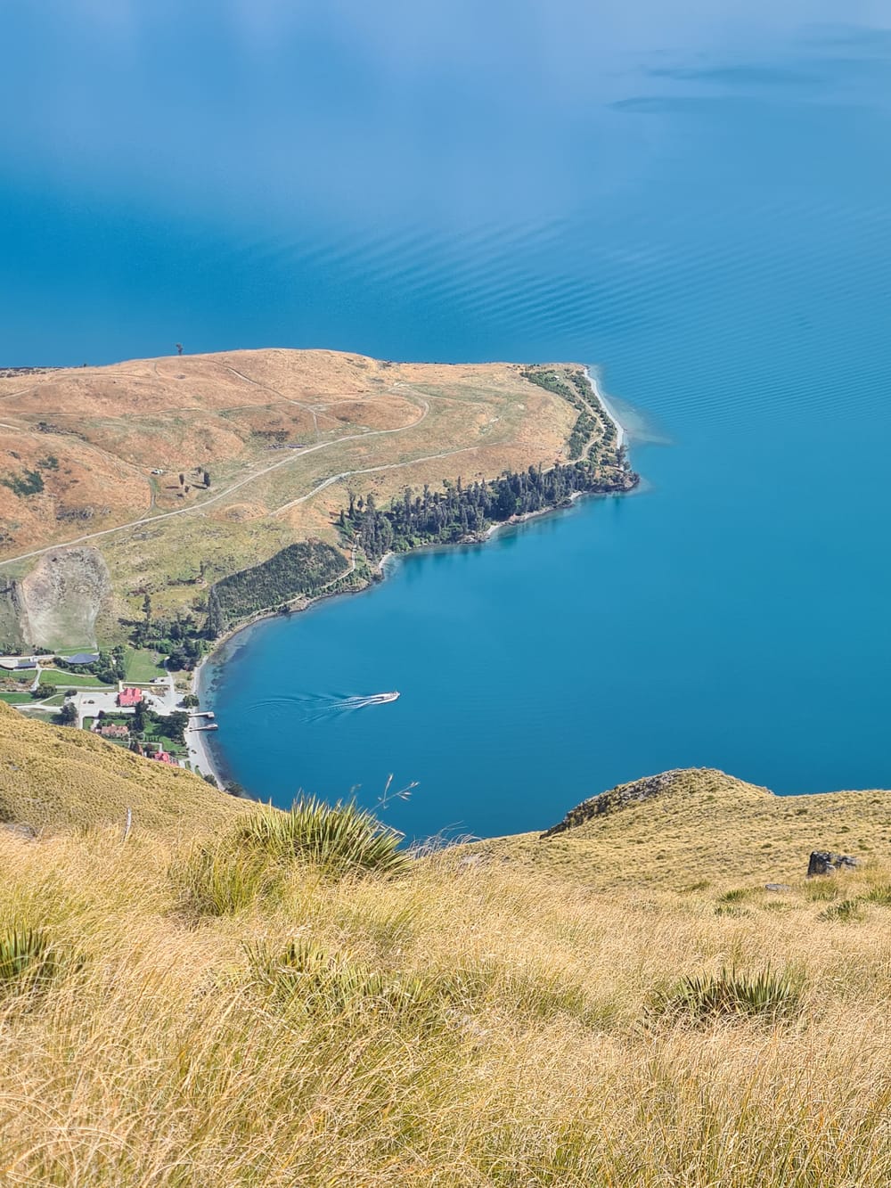
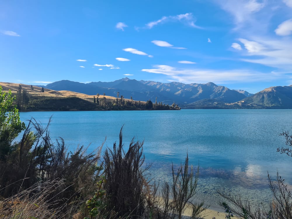
The campsite is an easy 900m stroll from the jetty and is in an absolutely beautiful location at the bottom of Walter Peak, with stunning views of a crystal clear Lake Wakatipu.
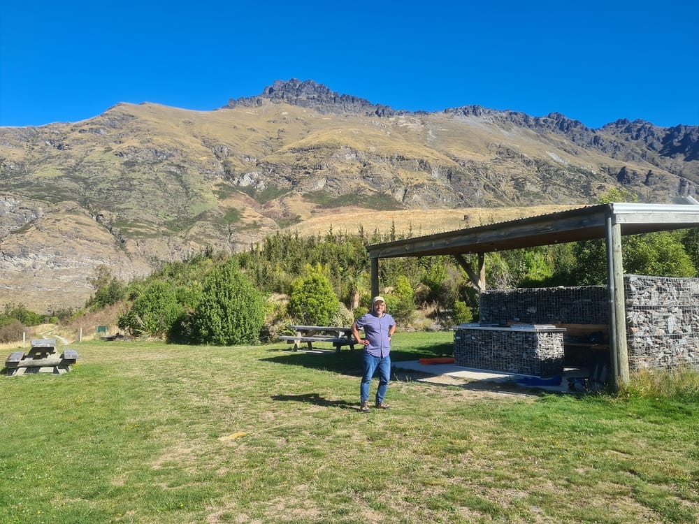
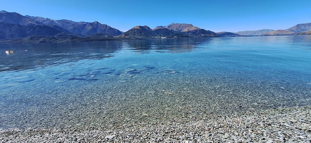
The campsite is equipped with a covered cooking area that has some flash gas fryers as well as a long drop and that is it. The area is well grassed and perfect for pitching a tent. There was no obvious signs of a tap or fresh water supply and while the lake water looks very tempting, given the state of many NZ waterways, a water filter would be recommended if you are camping here (or you walk fill up at the station).

Rising at 5am we pulled our campsite down, donned our head lamps and headed for the station. The station had kindly agreed the day before to let us leave our camping gear in a store room near the jetty. From here we took our last comfort stop and topped up our water bottles. The day turned out to be much longer and tougher than I expected, with my 3.5 litres proving not to be enough but more on that later.
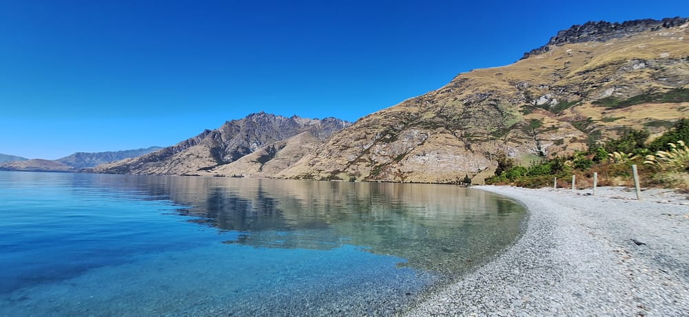
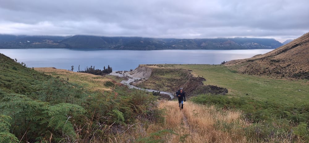
The first 3 km (approximately) is an easy, flat stroll along the edge of the lake, eventually turning inland to the base of the mountain which then gets steep very quickly. As you enter private land, you will need to sign some indemnity forms and so it pays to have a pen on hand.
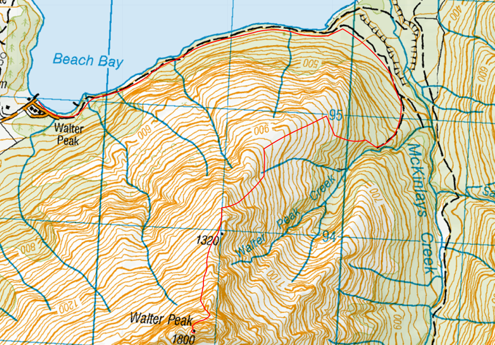

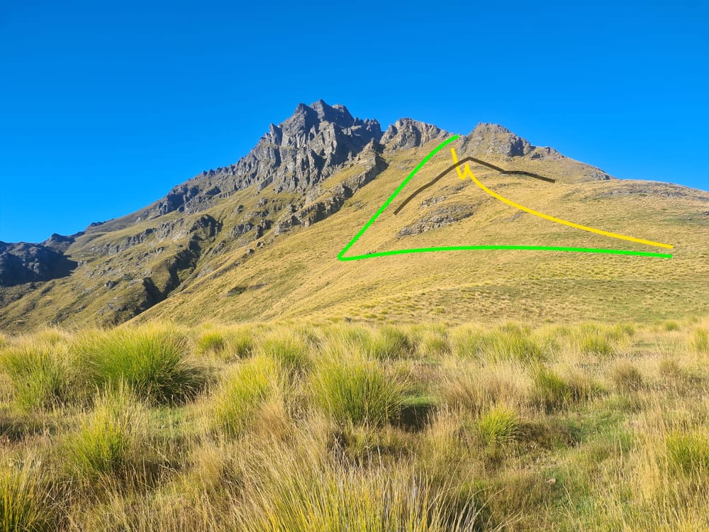
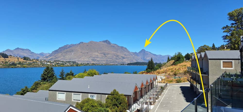
Because of the scale, the above image does not clearly show a blind ridge that blocked our path. On the way up we followed the yellow line but we should have gone the green route. The black line represents the blind ridge that we could not safely pass so had to back-track a little to get to the top.
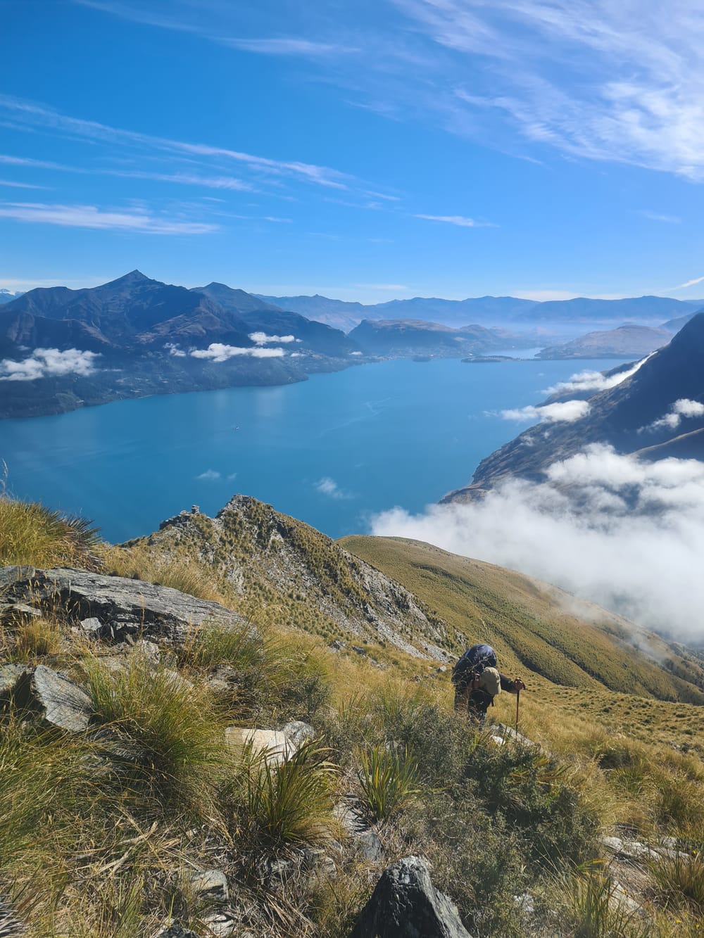

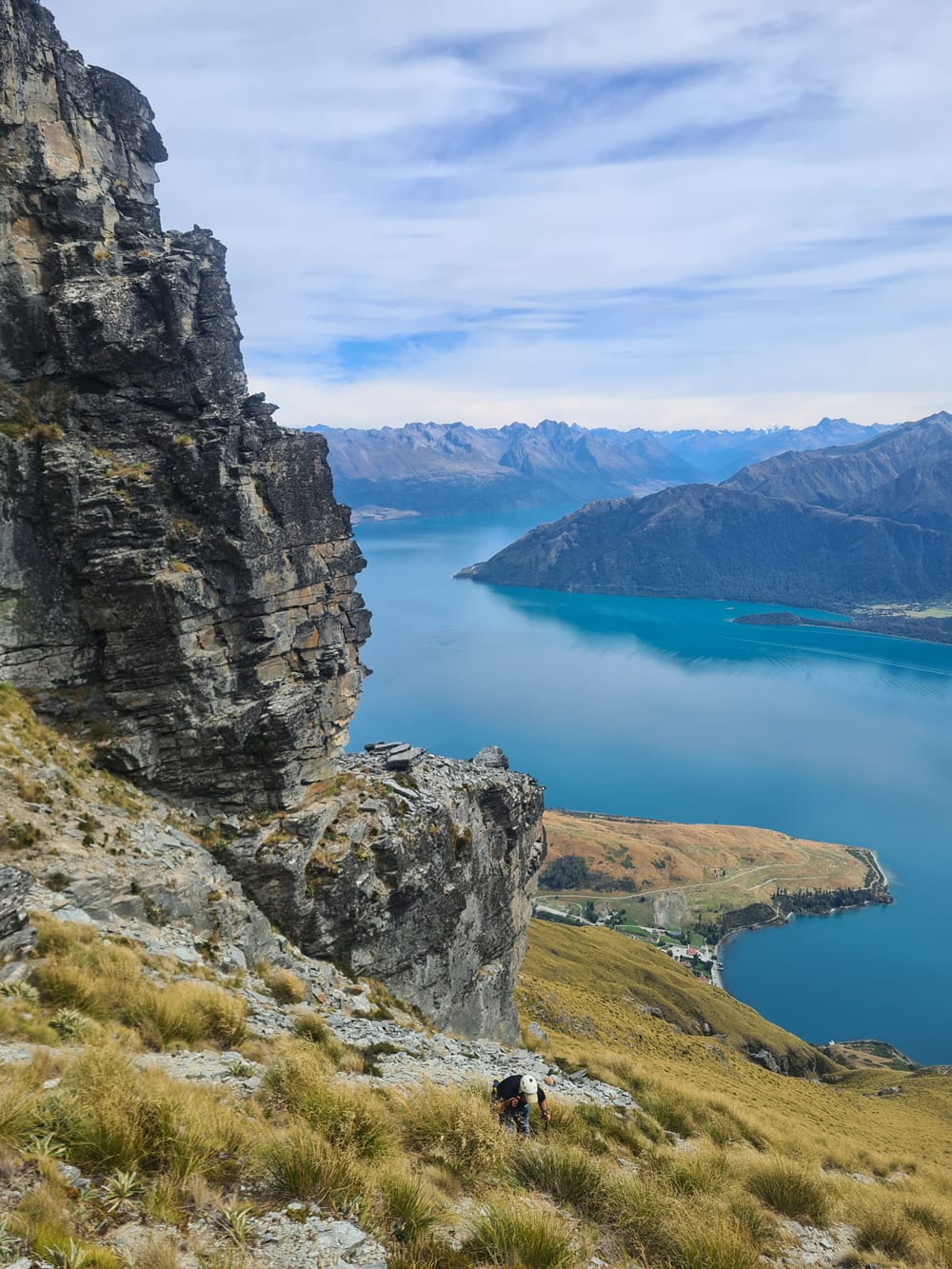
By the time we got here, I was thoroughly broken and the only thing that kept me going was the desire not to let my son-in-law down; I am very glad that I did press on.
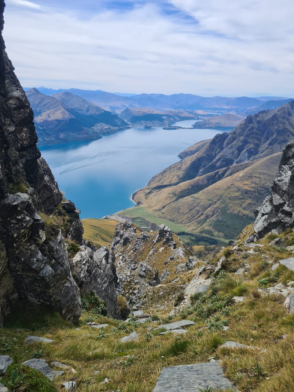
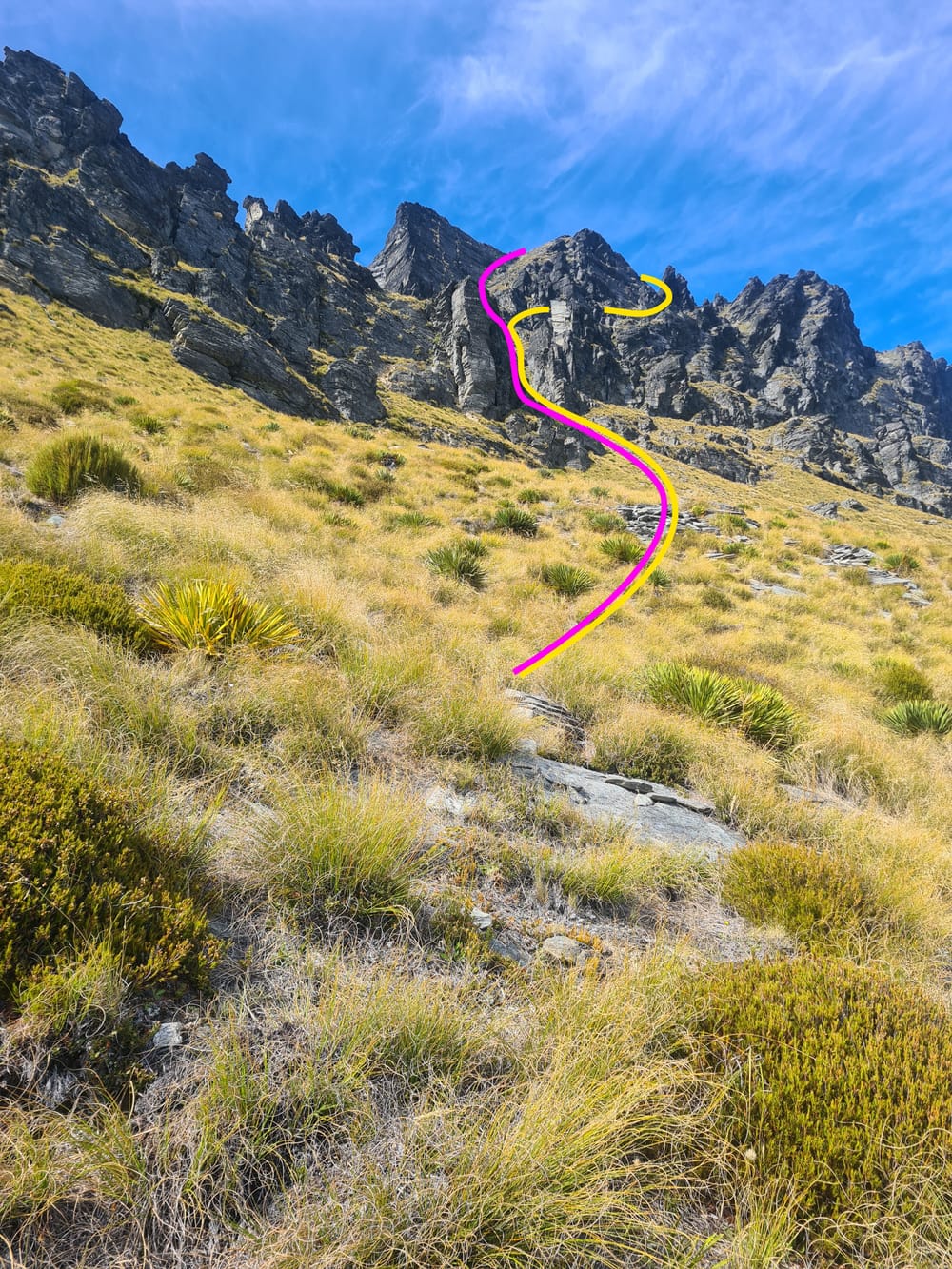
The yellow line is the route that we took. We had a brief look at the purple route and wondered if that might have been an easier scramble. Time and fatigue however prevented us from investigating further.
Most of the route is on very sketchy tracks which are made very difficult to navigate because of the grass. Crampons or some sort of spikes would have made things much easier; both going up and coming down. At one point in the decent, I simply sat on my butt and shortened my Nordic sticks, using them like ski poles to ski down the slope.

We used OSONZAC's trip as a basis for planning this hike, summiting using their route. For the average non-climber, the scramble is not for the fainthearted and while we landed up doing it without ropes, an abseil would have made things much easier. Also I feel that there would be nothing wrong with recommending using a belay to ascend.
And then came the decent.
Round about here we ran out of water, having about four hours left to go. Now four hours does not seem long to go without water but after such a physically taxing day, by the time we reached the bottom, we were not happy trampers, feeling rather dehydrated (there is no water on the mountain).
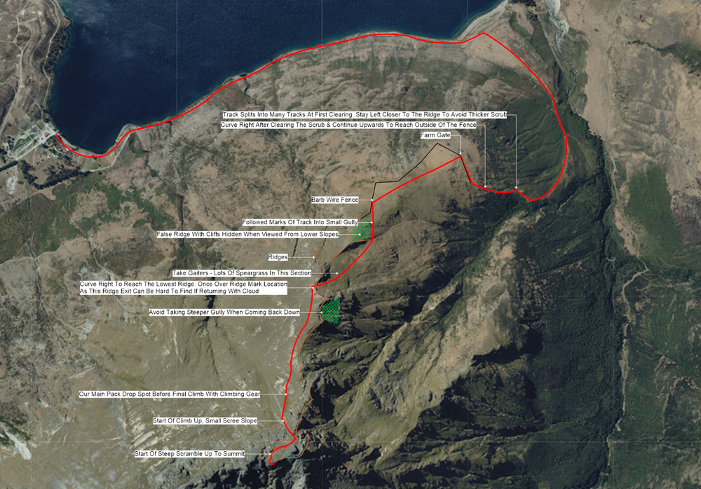
On the way down there are several exits off of the ridge that look similar and we took one too early which landed up to be a very steep gully, requiring back-tracking. Once back at the farm we learnt that, within the previous few weeks, another party also got lost and also nearly landed themselves in some difficulty. The lesson here is to take careful note when you change directions going up so that you can reverse this when coming back down.
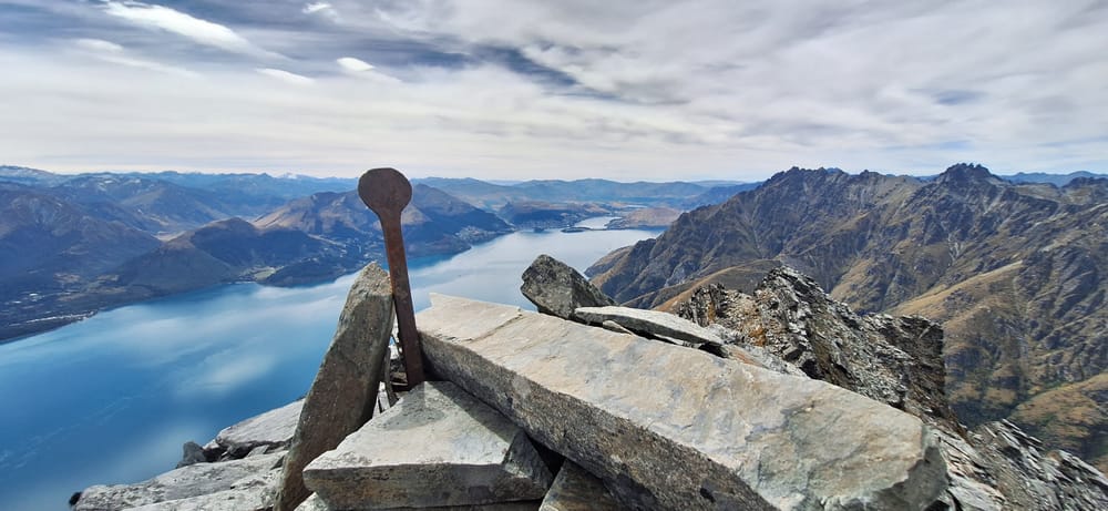
We got back around 7pm, rehydrated and then waited for the TSS Earnslaw to take us back to Alpine Village on its 8:15pm trip. I rate this as a triple B hike i.e. Beautiful But Brutal; but in spite of the later we can highly recommend it.